 To my Jewish, Messianic, and Christian brethren who remember Yeshua’s death and resurrection in the Passover and the Feast of Unleavened Bread, I wish you a blessed and meaningful week. And to my Christian brethren who celebrate Easter in remembrance of Yeshua, I also wish you blessed and meaningful celebration.
This week, I’d like to share with you why all of us who remember Yeshua’s death and resurrection during this time of year find common grounds in the Messianic symbolism of the Exodus story. What is awesome about this subject is that we serve a living God who choose the descendants of Abraham, Isaac, and Jacob as a special people, whose lives and history would be living testimony to Yahweh’s redemptive plan for mankind, through Yeshua (Jesus). This living witness to Yahweh’s redemptive plan is no place better demonstrated than in the story of Israel’s Exodus from Egypt. It is this story that provides the template upon which Jewish, Messianic, and Christian believers find common ground upon which to view the living God of the Bible at work redeeming His people, in the past, present, and future.
So today I want to tell you about the Spirit of Prophecy, I want to tell you about Yahweh’s Salvation (His Yeshua) and how He is so awesomely and beautifully symbolized in the Exodus story.
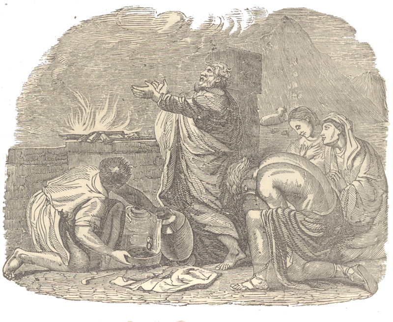
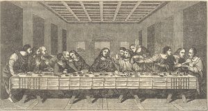
In the New Testament we learn that Yeshua was understood by the early church to be represented in Passover as the “lamb of God which taketh away the sins of the world”. Thankfully the story of our redemption didn’t end with the death of Yeshua. It was His miraculous resurrection that made His death relevant as the means to our salvation.
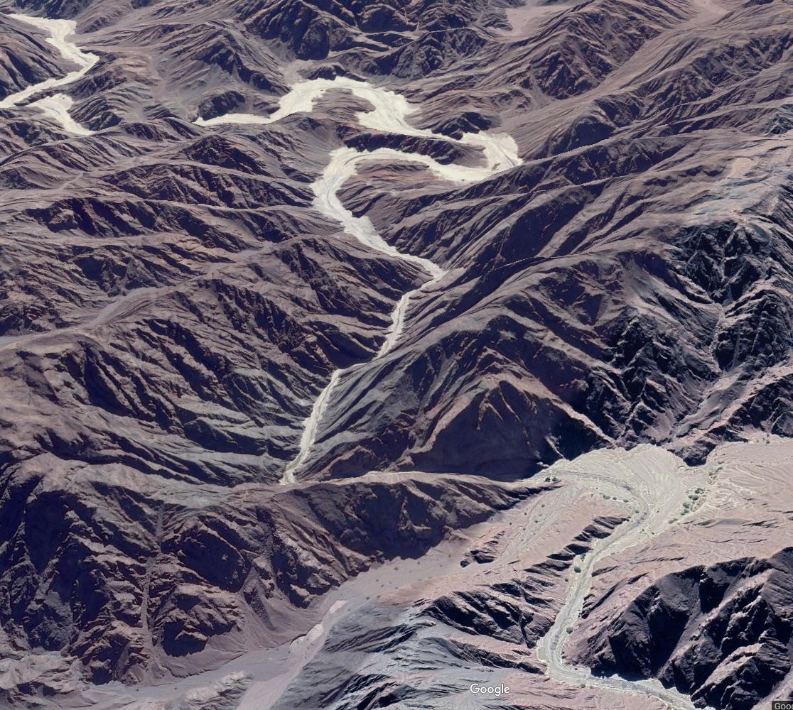
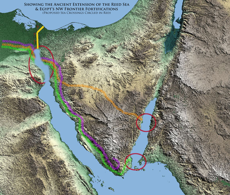
I’ve spent the last couple of months looking at the Exodus story as it relates to the Reed Sea crossing and the location of Mount Sinai. With this foundation in Biblical history let me ask you a question. If the killing of the Passover lambs represented Yeshua’s death and mankind’s atonement for sin, then what part of the Exodus story do you believe represents the resurrection? For those who might not be sure, here are a few verses which provide us with the answer:
Our fathers understood not thy wonders in Egypt; they remembered not the multitude of thy mercies; but provoked him at the sea, even at the Red sea. Nevertheless he saved them for his name’s sake, that he might make his mighty power to be known. He rebuked the Red sea also, and it was dried up: so he led them through the depths, as through the wilderness. And he saved them from the hand of him that hated them, and redeemed them from the hand of the enemy. (Psalm 106:7-10)
Blessed be the Lord God of Israel; for he hath visited and redeemed his people, And hath raised up an horn of salvation for us in the house of his servant David; As he spake by the mouth of his holy prophets, which have been since the world began: That we should be saved from our enemies, and from the hand of all that hate us; To perform the mercy promised to our fathers, and to remember his holy covenant; The oath which he sware [Shaba] to our father Abraham, (Luke 1:68-73)
But God commendeth his love toward us, in that, while we were yet sinners, Christ died for us. Much more then, being now justified by his blood, we shall be saved from wrath through him. (Romans 5:8-9)
Moreover, brethren, I would not that ye should be ignorant, how that all our fathers were under the cloud, and all passed through the sea; And were all baptized unto Moses in the cloud and in the sea; And did all eat the same spiritual meat; And did all drink the same spiritual drink: for they drank of that spiritual Rock that followed them: and that Rock was Christ. (1 Corinthians 10:1-4)
Know ye not, that so many of us as were baptized into Jesus Christ were baptized into his death? Therefore we are buried with him by baptism into death: that like as Christ was raised up from the dead by the glory of the Father, even so we also should walk in newness of life. For if we have been planted together in the likeness of his death, we shall be also in the likeness of his resurrection: (Romans 6:3-5)
They forgat God their savior [yasha], which had done great things in Egypt; Wondrous works in the land of Ham, and terrible things by the Red sea. (Psalm 106:21-22)
But after that the kindness and love of God our Saviour toward man appeared, Not by works of righteousness which we have done, but according to his mercy he saved us, by the washing of regeneration, and renewing of the Holy Ghost; Which he shed on us abundantly through Jesus Christ our Saviour. (Titus 3:4-6)
Buried with him in baptism, wherein also ye are risen with him through the faith of the operation of God, who hath raised him from the dead. (Colossians 2:12)
Pretty compelling, isn’t it? Israel’s redemption, yeah their salvation was wrought through the waters of the Reed Sea crossing. As evidenced in the New Testament passages above that symbol of salvation and redemption was the prophetic template upon which Yeshua’s resurrection was themed. In the Old Testament those events were immortalized in the Biblical holy days of Passover, Feast of Unleavened Bread, and Firstfruits. We’ll explore some of the wonderful threads of these prophetic shadows and types of the Exodus and the Reed Sea crossing in more detail below but I have another question for you related to the location of Reed Sea crossing.
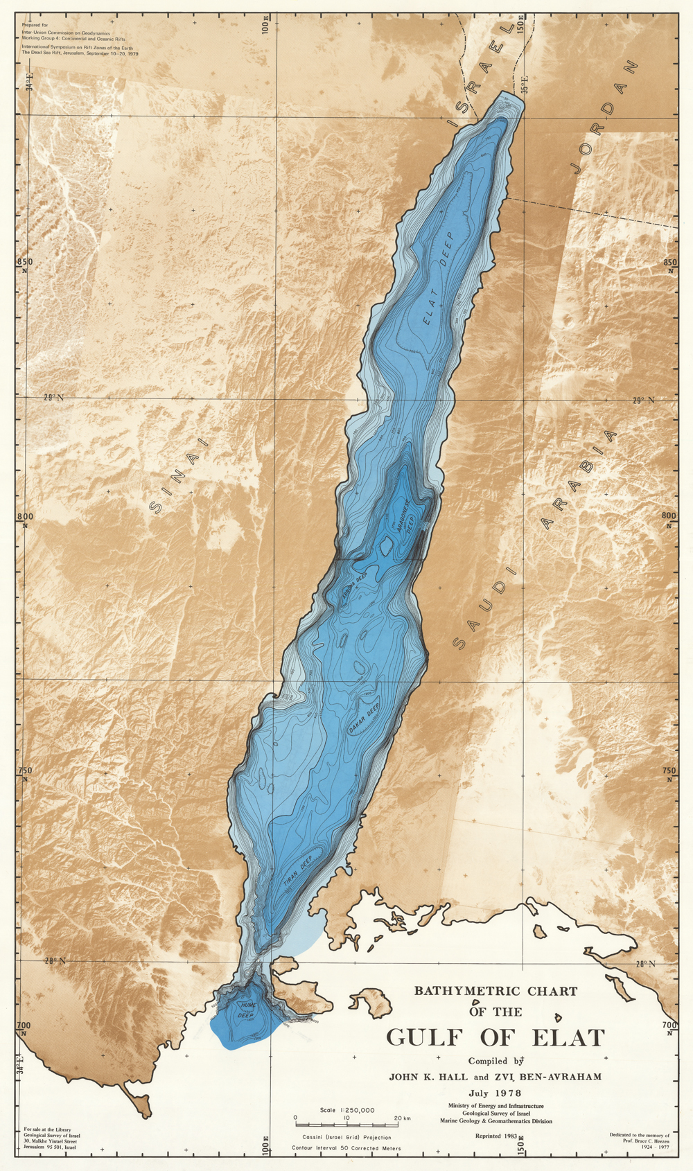
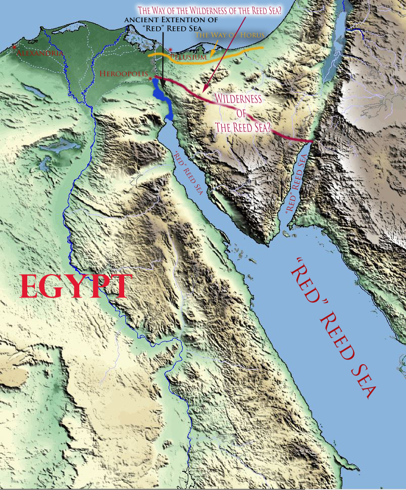
If Passover sacrifices represent Yeshua’s death for the sins of mankind in the Exodus events’ chronology and the Reed Sea crossing represents the resurrection, rebirth, and the salvation of mankind, then why are those events separated by 3-4 weeks in the Aqaba crossing theory? In other words, if we are to believe the Reed Sea crossing took place in the Gulf of Aqaba such an itinerary inadvertently separates the messianic redemptive symbolism of the Exodus events from the Feast of Unleavened Bread, the very Biblical mow’ed (divine appointment) given to represent mankind’s restoration and redemption. How is this possible?
I don’t believe it is possible. As I will demonstrate in the rest of this article, the congruency of the Bible’s messianic symbolism makes the Aqaba theory untenable for reasons besides those I’ve explored in my articles the last several weeks. The most compelling reason (as it relates to our faith in Yeshua and Yahweh’s redemptive plan), is described by the apostle Paul to the Corinthians:
For I delivered unto you first of all that which I also received, how that Christ died for our sins according to the scriptures; And that he was buried, and that he rose again the third day according to the scriptures:… (1 Corinthians 15:3-4)
Now if Christ be preached that he rose from the dead, how say some among you that there is no resurrection of the dead? But if there be no resurrection of the dead, then is Christ not risen: And if Christ be not risen, then is our preaching vain, and your faith is also vain. Yea, and we are found false witnesses of God; because we have testified of God that he raised up Christ: whom he raised not up, if so be that the dead rise not….. (1 Corinthians 15:12-15)
But now is Christ risen from the dead, and become the firstfruits of them that slept. For since by man came death, by man came also the resurrection of the dead. For as in Adam all die, even so in Christ shall all be made alive. But every man in his own order: Christ the firstfruits; afterward they that are Christ’s at his coming. (1 Corinthians 15:20-23)
Else what shall they do which are baptized for the dead, if the dead rise not at all? why are they then baptized for the dead? (1 Corinthians 15:29)
Pretty powerful and sobering words, aren’t they? You see by taking the Reed Sea crossing out of the Passover week we in effect make the Feast of Unleavened Bread and Firstfruits, the Bible’s premier symbols of Yahweh’s redemptive plan, worthless and vain. If we try to claim this 7 day feast, this divine mow’ed, is prophetic picture of the Messiah, according to Paul’s judgment, we are bearing false witness. Without the Reed Sea crossing, the Exodus is only a symbol of death and thus irrelevant to the Bible’s overall redemptive message.
Today, I want to reassure you regarding the congruency of the Bible’s redemptive message. I want to give you new confidence that in fact the Passover, the Feast of Unleavened Bread, and Firstfriuts are one of the most important, if not the most important, of the Bible’s prophetic pictures of Yahweh’s redemptive plan for mankind through His Yeshua.
As we explore this important subject I want to stress that my goal here is to strengthen your faith in the credibility of the Bible’s redemptive message. That message is that Yahweh loves each of you and from the foundation of the world he set in motion a redemptive plan for all of us which is beautifully and a congruently witnessed in the collection of 66 books we know today as the Bible.
The Water of Judgment and Redemption
To start off with, let’s look at the symbolism of water in the Bible. As we will see it is a powerful agent, both literally and metaphorically, in Yahweh’s redemptive plan. First let me take you to the book of Job, one of the oldest books in the Bible where we find a fascinating description of water and its regenerative nature in what could be argued is a messianic redemptive context:
For there is hope of a tree, if it be cut down, that it will sprout again, and that the tender branch thereof will not cease. Though the root thereof wax old in the earth, and the stock thereof die in the ground; Yet through the scent of water it will bud, and bring forth boughs like a plant. But man dieth, and wasteth away: yea, man giveth up the ghost, and where is he?
As the waters fail from the sea, and the flood decayeth and drieth up: So man lieth down, and riseth not: till the heavens be no more, they shall not awake, nor be raised out of their sleep. O that thou wouldest hide me in the grave, that thou wouldest keep me secret, until thy wrath be past, that thou wouldest appoint me a set time, and remember me! If a man die, shall he live again? all the days of my appointed time will I wait, till my change come. Thou shalt call, and I will answer thee: thou wilt have a desire to the work of thine hands. For now thou numberest my steps: dost thou not watch over my sin? My transgression is sealed up in a bag, and thou sewest up mine iniquity. (Job 14:7-17)
Behold, God is my salvation; I will trust, and not be afraid: for the YA – YHWH is my strength and my song; he also is become my salvation. Therefore with joy shall ye draw water out of the wells of salvation. (Isaiah 12:2-3)
Mankind’s 911 Moment
Water is not just used in a regenerative and life giving sense as described by the passage in Job. Sometimes, like in Genesis 9, water is used as a form of judgment and deliverance.
And I, behold, I establish my covenant with you, and with your seed after you; And with every living creature that is with you, of the fowl, of the cattle, and of every beast of the earth with you; from all that go out of the ark, to every beast of the earth. And I will establish my covenant with you; neither shall all flesh be cut off [karath] any more by the waters of a flood; neither shall there any more be a flood to destroy the earth. (Genesis 9:9-11)
Here is Genesis 9:11 we find the first occurrence of the Hebrew word karath (to cut or cut off) used to describe the destruction of mankind by the waters of the flood. It is here, where we also find that Yahweh makes a covenant with Noah and his “seed” for all their generations. This covenant promised that Yahweh would never again destroy all mankind with a flood of water. The token of this covenant was the rainbow.
So in this instance we see water used as an agent of judgment and redemption (deliverance). For those with the faith of Noah and his family, water was the means of their deliverance. For those without faith the water condemned them to death.
The apostle Peter describes the redemptive nature of water in the days of Noah and relates it to the redemptive and regenerative symbolism of baptism and the resurrection of Yeshua. Carefully notice in this passage that the “figure” of baptism is directly related to the “resurrection” of Christ.
For Christ also hath once suffered for sins, the just for the unjust, that he might bring us to God, being put to death in the flesh, but quickened by the Spirit: By which also he went and preached unto the spirits in prison; 20 Which sometime were disobedient, when once the longsuffering of God waited in the days of Noah, while the ark was a preparing, wherein few, that is, eight souls were saved by water. The like figure whereunto even baptism doth also now save us (not the putting away of the filth of the flesh, but the answer of a good conscience toward God,) by the resurrection of Jesus Christ: (1 Peter 3:18-21)
What powerful symbolism!
Daniel 9 & the Covenant and Mercy of Yahweh
To further elucidate the wonderful symbolism of water and the symbolic relationship to Yahweh’s redemptive plan, let’s turn to the most important messianic prophecy in the Bible found in Daniel chapter 9. In Daniel is recorded the only prophetic passage in the Bible which tells us specifically when Yahweh’s redeemer would come to save mankind from their sins. As I’ve explained in my article Seven, 70, & Sevens: Daniel 9 & the Bible’s Messianic Symbolism and in my book Daniel’s 70 Weeks: The Keystone of Bible Prophecy, Daniel 9 opens with Daniel’s plea to Yahweh to remember His “covenant and mercy”. That covenant we learned was in fact a call for Yahweh to remember the oath he sware (shaba) with Abraham which promised through his “seed” all nations of the earth would be blessed. As Daniel 9 unfolds Yahweh goes on to reveal to Daniel when that promised Seed would come and the redemptive nature of the messiah’s mission:
Seventy weeks [sevens] are determined upon thy people and upon thy holy city, to:
-
- finish the transgression
- and to make an end of sins
- and to make reconciliation for iniquity
- and to bring in everlasting righteousness
- and to seal up the vision and prophecy
- and to anoint the most Holy.
Know therefore and understand, that from the going forth of the commandment [dabar-word] to restore and to build Jerusalem unto the Messiah the Prince shall be seven weeks [sevens/70], … (Daniel 9:24-25)
It’s in Daniel 9:26 though that we find a connection to the flood of Noah and redemptive purpose of Yahweh. Here take a look:
And after threescore and two weeks shall Messiah be cut off [karath], but not for himself: (Daniel 9:26)
After telling us when the Messiah would come and what He would accomplish, Daniel 9:26 tells us that the Messiah would be karath “cut off” but not for himself. To a reader steeped in the Hebrew Scriptures the use of karath here in Daniel 9:26 might naturally lead one to think of destruction of mankind by their being karath (cut off) by the waters of the flood. Notice in Daniel 9:26 it implies that the Messiah was cut off but not for himself. (He made reconciliation for the sins of others). Contrast that with the days of Noah where mankind was indeed karath (cut off) for their own sins.
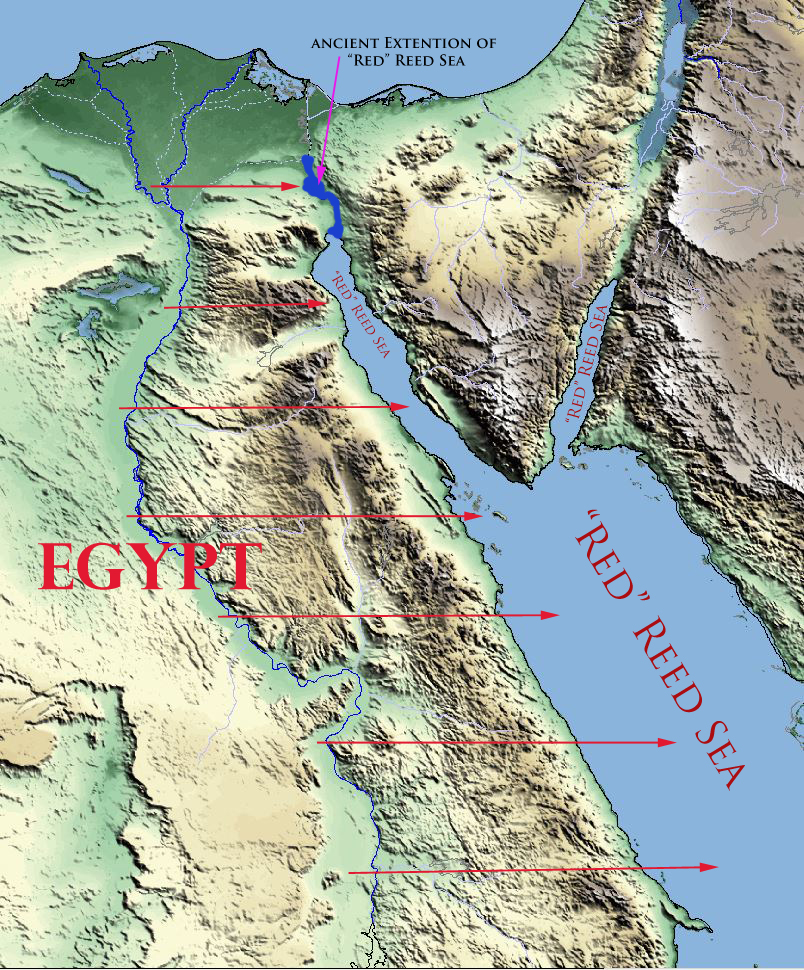
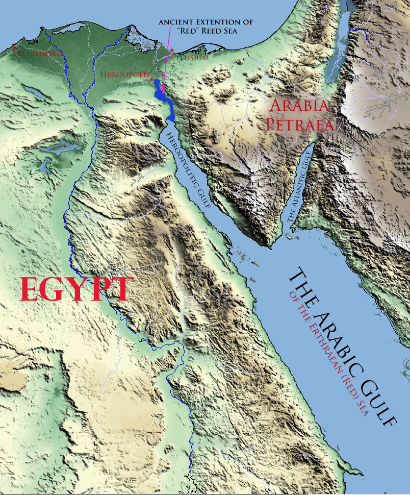
But there is an even more thrilling connection between the waters of Noah’s flood and the deliverance of mankind. You see the ark rested and mankind (Noah and his family) was delivered from the waters of the flood on 17th day of the 1st month. As I’ve explained in my articles The Story of Halloween and Part II of that series The Flood, the Exodus of Israel, and the Coming of the Messiah, a reasonable case can be made that 17th day of the 7th month of the calendar used in Noah’s day would have equated to the 17th day of the 1st month of the post Exodus calendar. (In Noah’s day the calendar year began in the fall.)
In other words mankind’s deliverance from Yahweh’s judgment (by the waters of the flood) took place during the same week and month of the year (possibly the very same day of the week) that Israel crossed the Reed Sea as well as the same week and month that Yeshua of Nazareth died for our sins and then rose again from the grave. How is that for a congruent Biblical redemptive theme!
The Waters of Baptism
Let’s dig into the subject of baptism and its redemptive symbolism. In the following passage we see that there is no question that the waters of baptism symbolize the washing away of sin, and the restoration and rebirth of mankind by Yeshua’s death and resurrection. Let’s start by looking at Yeshua’s own words where he talks about his baptism and then the words of Paul were he explains Yeshua’s baptism was a symbol of His death.
But Jesus answered and said, Ye know not what ye ask. Are ye able to drink of the cup that I shall drink of, and to be baptized with the baptism that I am baptized with? They say unto him, We are able. And he saith unto them, Ye shall drink indeed of my cup, and be baptized with the baptism that I am baptized with: but to sit on my right hand, and on my left, is not mine to give, but it shall be given to them for whom it is prepared of my Father. (Matthew 20:22-23)
Know ye not, that so many of us as were baptized into Jesus Christ were baptized into his death? Therefore we are buried with him by baptism into death: that like as Christ was raised up from the dead by the glory of the Father, even so we also should walk in newness of life. For if we have been planted together in the likeness of his death, we shall be also in the likeness of his resurrection: (Romans 6:3-5)
And from Jesus Christ, who is the faithful witness, and the first begotten of the dead, and the prince of the kings of the earth. Unto him that loved us, and washed us from our sins in his own blood, (Revelation 1:5)
And now why tarriest thou? arise, and be baptized, and wash away thy sins, calling on the name of the Lord. (Acts 22:16)
But God commendeth his love toward us, in that, while we were yet sinners, Christ died for us. Much more then, being now justified by his blood, we shall be saved from wrath through him. (Romans 5:8-9)
For Christ also hath once suffered for sins, the just for the unjust, that he might bring us to God, being put to death in the flesh, but quickened by the Spirit: By which also he went and preached unto the spirits in prison; Which sometime were disobedient, when once the longsuffering of God waited in the days of Noah, while the ark was a preparing, wherein few, that is, eight souls were saved by water. The like figure whereunto even baptism doth also now save us (not the putting away of the filth of the flesh, but the answer of a good conscience toward God,) by the resurrection of Jesus Christ: (1 Peter 3:18-21)
And finally let’s complete the picture by once again letting the apostle Paul lead the way as he explains how Israel’s crossing of the Reed Sea was a picture of their baptism accomplished by the leading and power of Christ.
Moreover, brethren, I would not that ye should be ignorant, how that all our fathers were under the cloud, and all passed through the sea; And were all baptized unto Moses in the cloud and in the sea; And did all eat the same spiritual meat; And did all drink the same spiritual drink: for they drank of that spiritual Rock that followed them: and that Rock was Christ. (1 Corinthians 10:1-4)
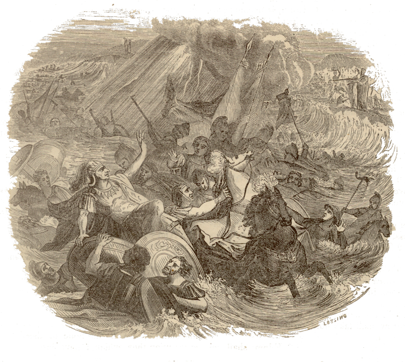
Our fathers understood not thy wonders in Egypt; they remembered not the multitude of thy mercies; but provoked him at the sea, even at the Red sea. Nevertheless he saved them for his name’s sake, that he might make his mighty power to be known. He rebuked the Red sea also, and it was dried up: so he led them through the depths, as through the wilderness. And he saved them from the hand of him that hated them, and redeemed them from the hand of the enemy. (Psalm 106:7-10)
This Moses whom they refused, saying, Who made thee a ruler and a judge? the same did God send to be a ruler and a deliverer by the hand of the angel which appeared to him in the bush. He brought them out, after that he had shewed wonders and signs in the land of Egypt, and in the Red sea, and in the wilderness forty years. This is that Moses, which said unto the children of Israel, A prophet shall the Lord your God raise up unto you of your brethren, like unto me; him shall ye hear. (Acts 7:35-37)
But with the precious blood of Christ, as of a lamb without blemish and without spot: Who verily was foreordained before the foundation of the world, but was manifest in these last times for you, Who by him do believe in God, that raised him up from the dead, and gave him glory; that your faith and hope might be in God. (1 Peter 1:19-21)
He is not here, but is risen: remember how he spake unto you when he was yet in Galilee, Saying, The Son of man must be delivered into the hands of sinful men, and be crucified, and the third day rise again. (Luke 24:6-7)
Now when Jesus was risen early the first day of the week, he appeared first to Mary Magdalene, out of whom he had cast seven devils. (Mark 16:9)
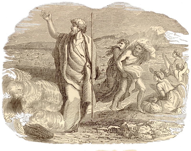
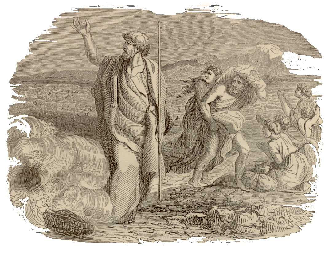
The Reed Sea Crossing and the Resurrection
By these (and other) marvelously congruent witnesses we can reasonably claim that Israel’s crossing over the Reed Sea was means by which Yahweh the living God of the Bible saved His people. This “baptism” through the waters of the sea saved Israel and delivered them from Pharaoh’s hatred and their servitude to Egypt. Israel entered the waters of the Reed Sea slaves to Pharaoh and they came out of those waters born again as the servants of the living God of the Bible. The Reed Sea crossing broke the power Pharaoh had over the children of Israel.
The witnesses above also inform us that the Exodus story was a type or shadow which was fulfilled in Yeshua of Nazareth. Yeshua’s death and resurrection were the means by which Yahweh saved mankind from their sins. These verses further explain that baptism is a symbol of Yahweh’s redemptive work at Calvary. Just as the waters of the Reed Sea delivered Israel from the hand of Pharaoh in Egypt, Yeshua’s death and resurrection were the means by which mankind was delivered from the hate of Satan (the god of this world) and certain death wrought by our sins. These pictures are the underlying theme of Yahweh’s redemptive plan for mankind. Let’s now look at that plan in terms of the Bible’s prophetic words.
The Spirit of Prophecy and the Feast of Unleavened Bread
The book of Revelation provides us with an often overlooked key that helps us understand the Bible’s prophetic redemptive message. In Revelation 19:10 it tells us that the “spirit of prophecy is the testimony of Jesus” (Yeshua). As I’ve often repeated at this blog, the Hebrew word for Jesus is Yeshua. Yeshua is a combination of two Hebrew words. The first is the proper name of Yahweh the living God of the Bible and the second part of the name of Yeshua comes from the Hebrew word Yasha (salvation). So when Revelation tells us the “spirit” of prophecy is the testimony of Yeshua, it is literally telling us that the spirit of prophecy is Yahweh’s Salvation.
This spirit of prophecy then is Yahweh’s Salvation (Yeshua) – His redemptive plan for restoring mankind to their intended state. This is the underlying thread which congruently binds the entire prophetic message of the Bible. So any time you have a prophetic passage, you’ll find within that prophecy a thread of Yahweh’s redemptive plan for mankind.
One of the best panoramic summations of Yahweh’s redemptive plan (and one of my favorite) was given by the apostle Peter in Acts 3 after he had healed the lame man in Solomon’s porch in the Temple. Absorb these wonderful words for a moment and I’ll do my best to explain how they relate to the Spirit of Prophecy and the Exodus:
And when Peter saw it, he answered unto the people, Ye men of Israel, why marvel ye at this? or why look ye so earnestly on us, as though by our own power or holiness we had made this man to walk?
13 The God of Abraham, and of Isaac, and of Jacob, the God of our fathers, hath glorified his Son Jesus; whom ye delivered up, and denied him in the presence of Pilate, when he was determined to let him go. 14 But ye denied the Holy One and the Just, and desired a murderer to be granted unto you; 15 And killed the Prince of life, whom God hath raised from the dead; whereof we are witnesses.
….But those things, which God before had shewed by the mouth of all his prophets, that Christ should suffer, he hath so fulfilled. 19 Repent ye therefore, and be converted, that your sins may be blotted out, when the times of refreshing shall come from the presence of the Lord; 20 And he shall send Jesus Christ, which before was preached unto you: 21 Whom the heaven must receive until the times of restitution of all things, which God hath spoken by the mouth of all his holy prophets since the world began.
For Moses truly said unto the fathers, A prophet shall the Lord your God raise up unto you of your brethren, like unto me; him shall ye hear in all things whatsoever he shall say unto you. 23 And it shall come to pass, that every soul, which will not hear that prophet, shall be destroyed from among the people. 24 Yea, and all the prophets from Samuel and those that follow after, as many as have spoken, have likewise foretold of these days. 25 Ye are the children of the prophets, and of the covenant which God made with our fathers, saying unto Abraham, And in thy seed shall all the kindreds of the earth be blessed. 26 Unto you first God, having raised up his Son Jesus, sent him to bless you, in turning away every one of you from his iniquities. (Acts 3:12-26)
As Peter understood it, Yahweh’s redemptive plan through Yeshua was preached by all the prophets since the world began. This prophet Yeshua, (likened unto Moses), was also the fulfillment of Yahweh’s shaba (oath) – His oath of sevens – which he swore with Abraham that through his “seed” all nations of the earth would be blessed . Peter further explains it was through the resurrection of Yeshua from the grave that Yahweh blessed Israel by turning them from their iniquities. (For more on the wonderful congruency of Yahweh’s redemptive plan (His Oath of Sevens), Daniel 9 & the Bible’s messianic symbolism please see my article Seven, 70, & Sevens: Daniel 9 and the Bible’s Messianic Symbolism.)
[DISPLAY_ULTIMATE_PLUS]
The Spirit of Prophecy in Yahweh’s Mow’ed
As Peter explained above, Yahweh’s redemptive plan for mankind was spoken about by all His prophets since the world began. Chief among those prophets was Moses and some of the most vivid prophetic pictures of Yahweh’s redemptive plan for mankind are found in the 7 Biblical holy days Yahweh gave to Moses for the children of Israel to keep. These Biblical holy days, or as the Bible describes them Feasts of Yahweh (also Mow’ed or divine appointments), became the template which Yeshua has fulfilled in the past (the spring holy days) and will fulfill in the future (the fall holy days). The chart below gives an overview.
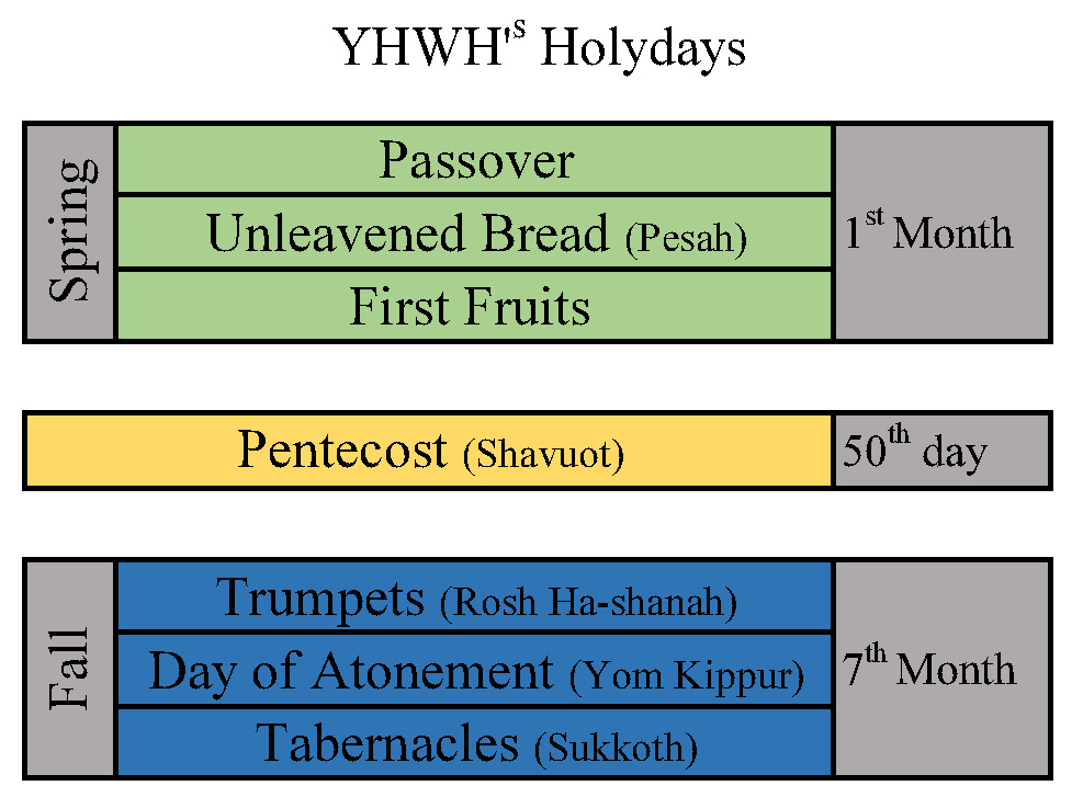
What’s special about the spring holy days and the count to Shavuot (Pentecost) is that they commemorate real Biblical history. Not only did they commemorate real history but they were so important, Yahweh ordered Israel to keep these feast days throughout all their generations and further He re-organized the Biblical calendar to being in the month these spring commemorations commence. With these instructions Israel became the custodian of Yahweh’s redemptive picture for mankind. A few verses illustrate this:
This is that Moses, which said unto the children of Israel, A prophet shall the Lord your God raise up unto you of your brethren, like unto me; him shall ye hear. This is he, that was in the church in the wilderness with the angel which spake to him in the mount Sina, and with our fathers: who received the lively oracles to give unto us: (Acts 7:37-38)
What advantage then hath the Jew? or what profit is there of circumcision? 2 Much every way: chiefly, because that unto them were committed the oracles of God. (Romans 3:1-2)
Think about the amazing congruency of these redemptive pictures, these oracles that the Jewish people safeguarded for us:
- In the days of Noah mankind was judged by Yahweh with the waters of the flood. Only eight souls were delivered from this judgment by Yahweh sealing them in the ark. Noah’s family was delivered from the waters when the ark rested on 17th day of the 7th month. In terms of the post Exodus calendar this equated to the 17th day of the first Biblical month.
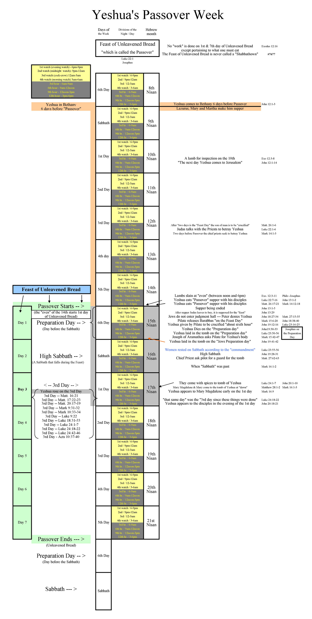
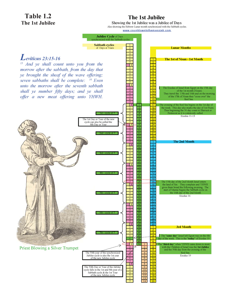
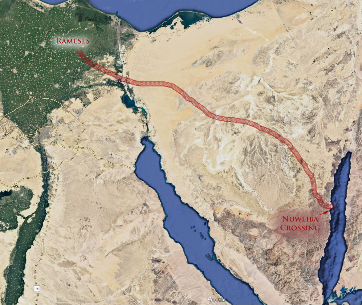
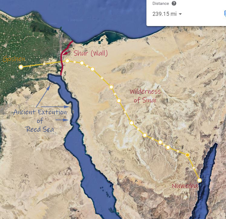
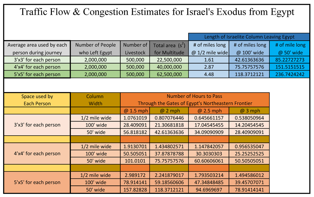
- In the days of Moses, Israel was delivered from the hand of Pharaoh and their servitude to Egypt when they passed through the Reed Sea. Taken in its most reasonable and plain sense reading of the text, Israel left Egypt the morning of the 15th day of the 1st month. Their journey to the Reed Sea took two or possibly three days which then dates their passage through the Reed Sea to the morning of the 17th or 18th day of the first Biblical month.
- In the days of Yeshua, He and His disciples ate the Passover (as required by the law) at even on the 14th of Nisan which began the 15th day of the 1st month. Two or three days later (depending on your view of the chronology) Yeshua rose from the grave on the 1st day of the week which would have been the 17th or 18th day of the 1st Biblical month.
- According to the law given to Moses, Israel was commanded to begin their countdown to Shavuot (Pentecost) on the 1st day of the week following the Sabbath day which fell within the Feast of Unleavened Bread. The apostle Paul makes it clear that He saw Yeshua as a type of this Firstfruits harvest.
But now is Christ risen from the dead, and become the firstfruits of them that slept. For since by man came death, by man came also the resurrection of the dead. 22 For as in Adam all die, even so in Christ shall all be made alive. But every man in his own order: Christ the firstfruits; afterward they that are Christ’s at his coming. (1 Corinthians 15:20-23)
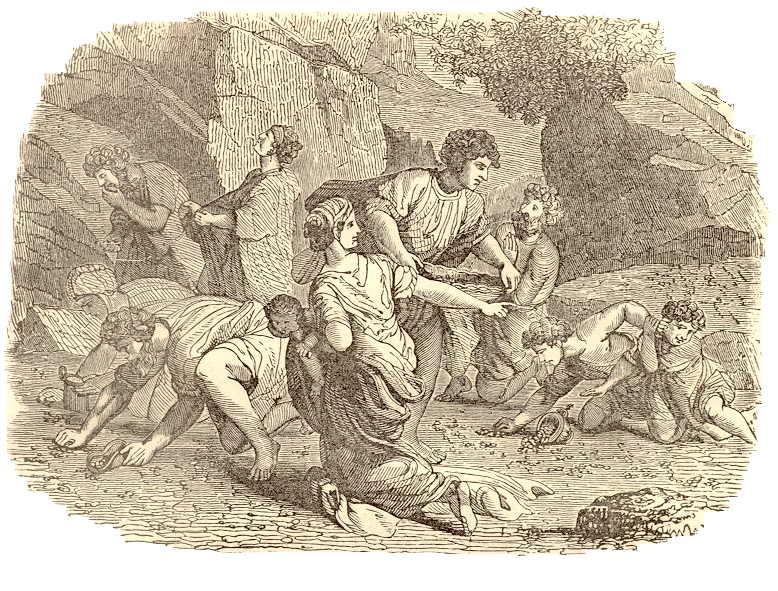
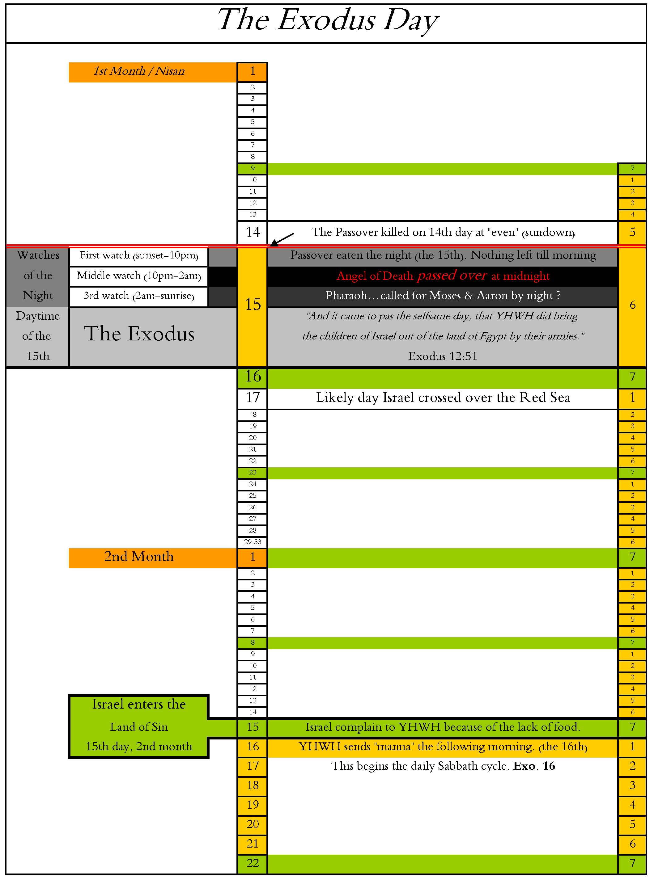
- Israel entered the wilderness of Sin on the 15th day of the 2nd month. The following day Yahweh provided manna for Israel to eat. Based upon the chronology provided in the text of Exodus, this made the 16th day of the 2nd month the 1st day of the week. If we run this chronology backwards to the Exodus of Israel from Egypt we find that the 1st day of the week (within the Feast of Unleavened Bread) fell on the 17th day of the first month – the very same day Israel may have crossed the Reed Sea and the very same day 1500 years later that Yeshua rose from the grave.
40 Years in the Wilderness
Let me give you one more example of the Bible’s messianic symbolism that has a fascinating connection to the Reed Sea crossing. After Israel crossed over the Reed Sea, Yahweh caused them to wander in the wilderness for forty years. How accurate do you believe the following verses are?
And your children shall wander in the wilderness forty years, and bear your whoredoms, until your carcases be wasted in the wilderness. After the number of the days in which ye searched the land, even forty days, each day for a year, shall ye bear your iniquities, even forty years, and ye shall know my breach of promise. (Numbers 14:33-34)
Nearly ten years ago I asked myself the same question. I wondered if it was theoretically possible to see if the Bible was speaking in general terms or if it really meant to convey a more specific period of time. You see the Bible tells us that Israel crossed over into the Promised Land on the 10th day of the 1st month at the end of 40 years wandering. We know from the Exodus account that Israel officially entered the wilderness after passing through the Reed Sea.
I used as my working theory the assumption that Israel crossed over the Reed Sea on the 17th day of the 1st month (in keeping with the chronology and symbolism we’ve discussed above). Adding 40 years (14609.6 days) to the starting date of the 17th day of the 1st month resulted in the expiration of the 40 years on the 9th day of the first month. In other words, it appeared based upon my calculations that those 40 years of wandering in the desert ended the day before Israel crossed over the Jordan river into the promised land.
And the people came up out of Jordan on the tenth day of the first month, and encamped in Gilgal, in the east border of Jericho. (Joshua 4:19)
Now I could have miscalculated but if I got the calculations correct it shows that when Yahweh said Israel would wonder in the wilderness for 40 years, He meant exactly 40 years. Think about his in terms of the Aqaba crossing theory. If proponents of the Aqaba theory are correct then the Reed Sea crossing took place at some point in the middle of the 2nd month. By this starting point for the 40 year countdown Israel would not have wondered in the wilderness the full forty years. For those interested in checking my work the following 188 page PDF file shows every day of the 40 years including month and year intercalations.
Passover to the Promised Land – 40 Years
A couple things with noting in the chart:
- Israel camped at the Jordan river on the 7th day of the 1st month – exactly 40 years from the day of the Exodus.
- Israel crossed over the Jordan and entered the Promised Land on the day after their 40 years expired. (This assumes the 17th day of the 1st month of the Exodus was the day Israel crossed the Reed Sea)
(Please note that in the provided chart I stated regarding the 10th day of the 1st month as the day Israel crossed the Jordan — “Israel crossed over the Jordan exactly 40 years to the day from crossing over the Red Sea”. I don’t remember why I worded it that way but it appears that back then my original basis would have been the 18th as the start of the 40 years. In any case it is a bit confusing. I did not have time to modify my original chart to make my statement more clear so I wanted to mention that here in the hopes of avoided any further confusion. In any case please take my calculations with a Berean’s skepticism and do your own due diligence.)
The Messianic Symbolism of the Crossing the Jordan
Now consider the events of the Jordan river crossing in a symbolic sense. Moses, (through whom came the law) was not allowed to enter the Promised Land. That privledge and responsibility was given to Yeshua who Israel had to follow by faith(Joshua = Jesus = Yeshua are all the same name). So this Old Testament Yeshua led Israel through the Jordan river exactly 40 years from the day of the Reed Sea crossing.
When the priest’s feet touched the waters of the Jordan the text tells us those waters back up all the way to Adam which is beside Zaretan. I can’t help see some redemptive symbolism here.
We know from multiple references which I’ve shared in this article that water is used as symbol of redemption, salvation, and judgment. Here in the book of Joshua we have the Old Testament Yeshua (Yahweh’s Salvation) leading Israel into the Promised Land after the waters of the river Jordan (meaning = ‘descender’) backed up to the city Adam (who brought sin into this world) and the city Zaretan (meaning = their distress).
Would it be too far fetch to say here that Israel’s crossing over the Jordan into the Promised Land was a symbol of Yeshua’s death and resurrection which brought cleansing and redemption to mankind after sin and distress entered the world in the days of Adam? Let’s take the symbolism one step further. What did Yahweh commanded Yeshua to do after crossing over the Jordan River? He commanded him circumcised the men of Israel. How appropriate then the words of Paul when taking about how new believers being spiritually circumcised by Yeshua.
In whom also ye are circumcised with the circumcision made without hands, in putting off the body of the sins of the flesh by the circumcision of Christ: Buried with him in baptism, wherein also ye are risen with him through the faith of the operation of God, who hath raised him from the dead. (Colossians 2:11-12)
And to cap off this symbolism, just a few days later Yeshua and the Children of Israel celebrated their first Passover in the Promised Land. Now how is that for an amazingly congruent picture of Yahweh’s redemptive plan through Yeshua?
Yahweh’s Salvation indeed!
My Final Thoughts on the Exodus and the Reed Sea Crossing
My hope is that the information I’ve shared with you in this article strengthens your faith in the Bible as a testimony of Yahweh’s wonderful redemptive plan through Yeshua. I also hope its spurs your interest in searching these things out for yourself. If you do I believe that you’ll have a renewed appreciation for the Exodus story and it chronology as a compelling and amazingly congruent foreshadowing of Yahweh’s Salvation – Yeshua.
For those of you who believe the Reed Sea crossing took place in the gulf of Aqaba, I hope you’ll take another look at the subject in light of the “spirit of prophecy”. The Passover, the Feast of Unleavened Bread, and the Feast of Firstfruits find their prophetic origins in the Exodus story. Without the symbolism of the Reed Sea crossing these divine appointments lose their redemptive and prophetic context. I hope you’ll consider that the real importance of the Reed Sea crossing and the Mount Sinai is not their geographical location but rather their prophetic context as templates or symbols of Yahweh’s redemptive plan for mankind.
May that context be your guiding light in this matter.
Maranatha!
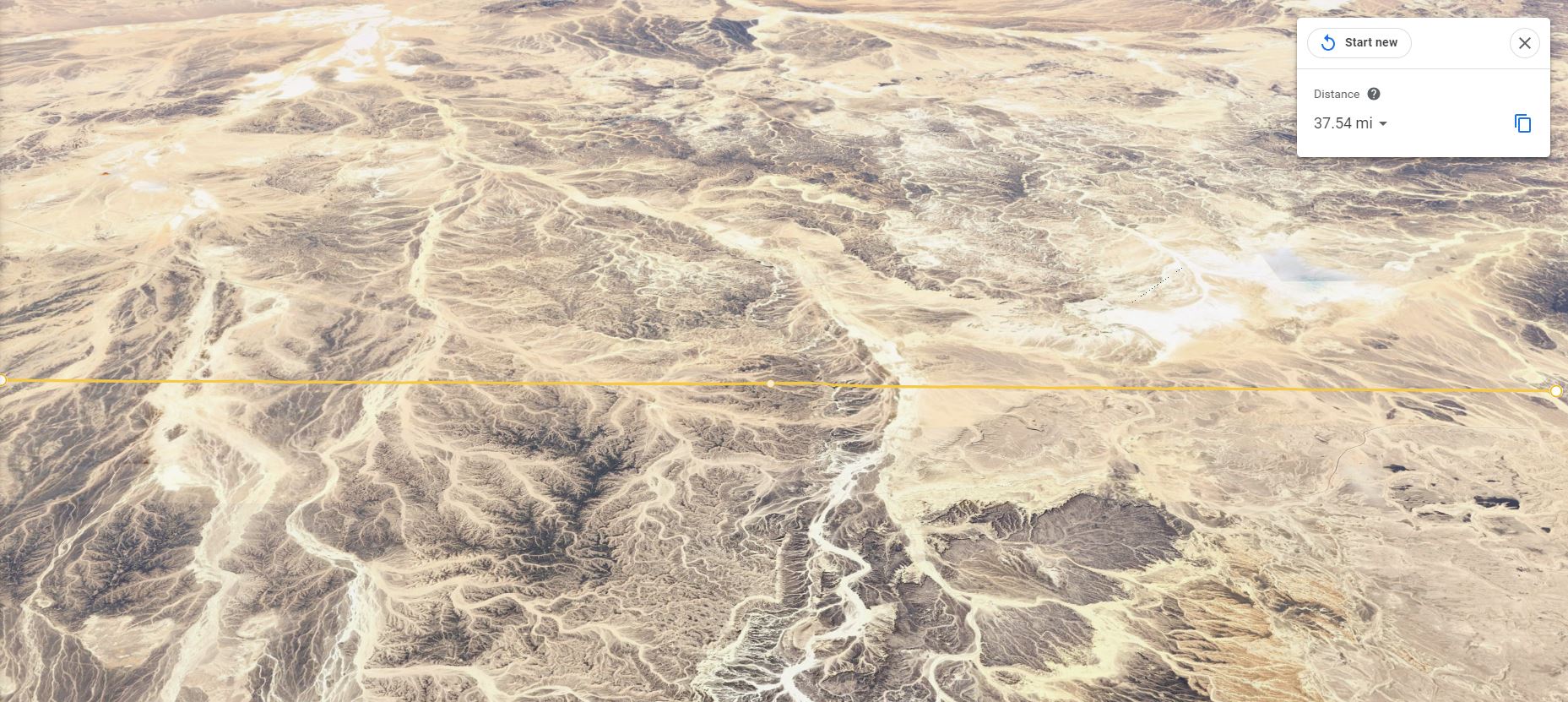
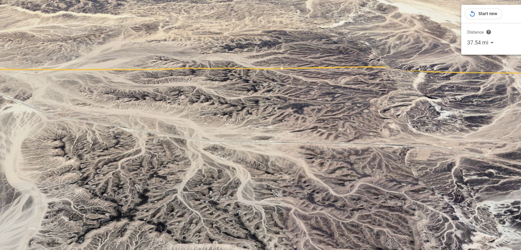
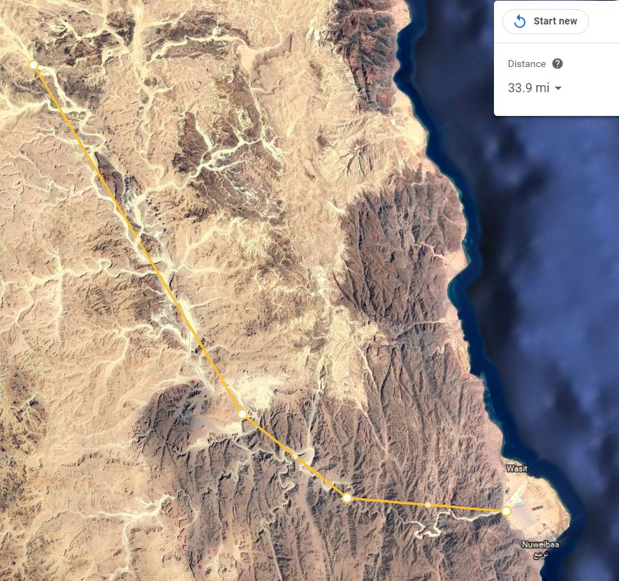
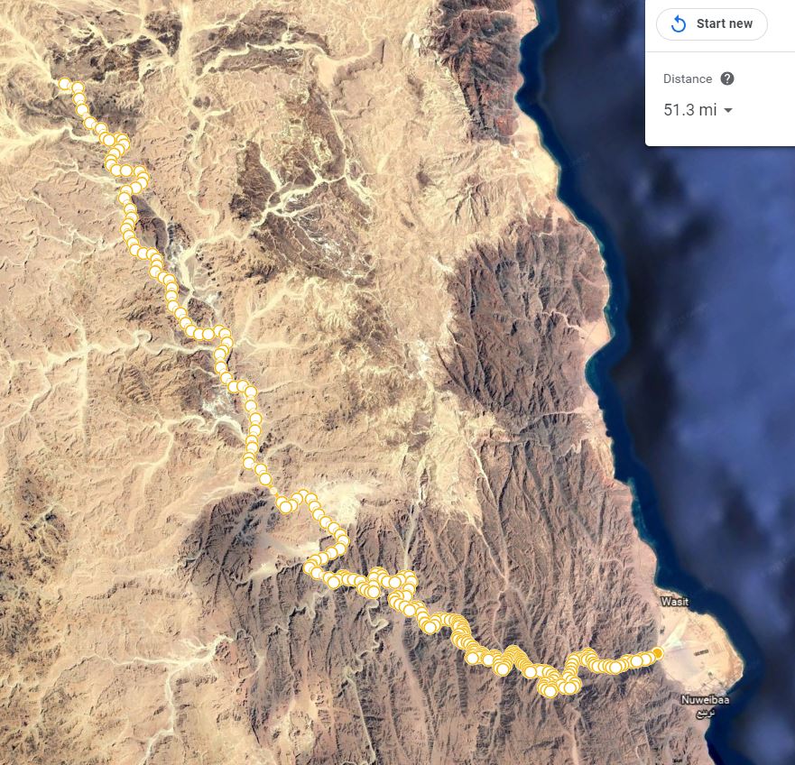
For those of you just joining us this is an ongoing series exploring the location of Mount Sinai and the Red Sea Crossing. I’d encourage you to first read Part I-III including the comments as they provide valuable context and information related to this subject. The following link will take you to those earlier articles.
Part I – Is Mount Sinai in Saudi Arabia
Part II – The Reed Sea Crossing: Which Gulf of the Red Sea?
Part III – Israel’s Crossing of the Reed Sea: The Geographical & Chronological Context
Part IV – Israel’s Crossing of the Reed Sea: Applying the Golden Rule of Bible Interpretation
Part V – The Exodus & Reed Sea Crossing: Symbols of the Bible’s redemptive Message
Click on Image to Enlarge
For Full chart please see the following PDF: Passover to the Promised Land


 Part I – Exploring the Claim that Mount Sinai is in Saudi Arabia

 Can you name the Biblical holyday when the following words were spoken?